
Riotur
Walk Rio
500 signs to explore Rio on foot
Overview
The Confederations Cup, the World Cup, the Pope’s visit and South America’s first Olympic Games made it clear that Rio needed a wayfinding system for people on foot. Brazil’s Ministry of Tourism and the City of Rio, together with Riotur, brought in a consortium led by ICON, with planning and design by London’s Applied Wayfinding. The result was 500 signs across 75 km² of the city, installed ahead of the 2016 Games. On the design and wayfinding team, we handled the final artwork for every sign, refined the detailed maps and laid out the simplified map.
The process
5 clusters
Signs per cluster, in route order
- Maracanã87 signs
- Centro141 signs
- Botafogo107 signs
- Zona Sul127 signs
- Barra da Tijuca38 signs
Diagnosis and clusters
The diagnosis mapped the city’s strengths, weaknesses and opportunities for pedestrians. Reaching Christ the Redeemer or Sugarloaf on foot was a mystery, and neighborhoods gave people little reason to walk from one to the next. The route was split into 5 clusters.
500 signs
In 4 types set by the tender
- Type 185 signs
- Type 2267 signs
- Type 391 signs
- Type 457 signs
4 sign types
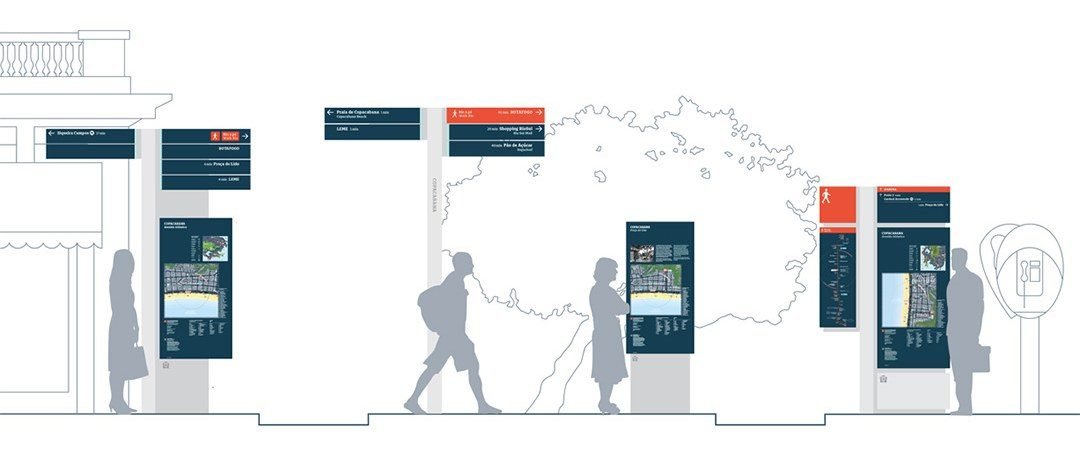
The 500 signs follow 4 types set by the tender, each with its own job. Numbers 1 to 4 appear again on the sign family just below.
Sign family
Four sign types, scaled for people walking on the sidewalk. The numbers on the image mark each one.
Type 1: directional arrows at the top and, at the base, a macro and micro map of the area, so people can find where they are and see beyond the route.
Type 2: direction only. Arrows in four directions, with the destination and the walking minutes to get there.
Type 3: placed at tourist attractions. It has a detailed map of a 30-minute radius, listing what is in each sector, and, at the top and on the back, the story of the place. At Praça do Lido, it tells what the square is and what happened there.
Type 4: the route sign. At the top, the minutes to the next attraction; on the side, the whole route; on the panel, the city map, the local map and directional arrows.
City Route
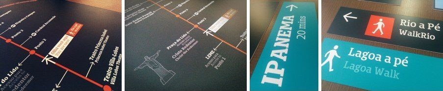
Type 4 marks the City Route, a walking route designed to link Rio’s most visited places. It starts at the Leblon lookout, follows the beachfront to Arpoador and Copacabana, goes through the Túnel Novo to Botafogo and continues through Flamengo, Largo do Machado, Glória, Lapa and Cinelândia to Maracanã, passing the Sambadrome.
Three shorter routes use variations of type 4: Barra a pé, along the Barra beachfront; Lagoa a pé, around the Rodrigo de Freitas lagoon; and Flamengo a pé, in Flamengo Park. Lagoa and Flamengo connect to the City Route on the maps. Barra stayed apart, since the subway did not reach it yet and the focus was the South Zone, Botafogo, downtown and Maracanã.
Two norths
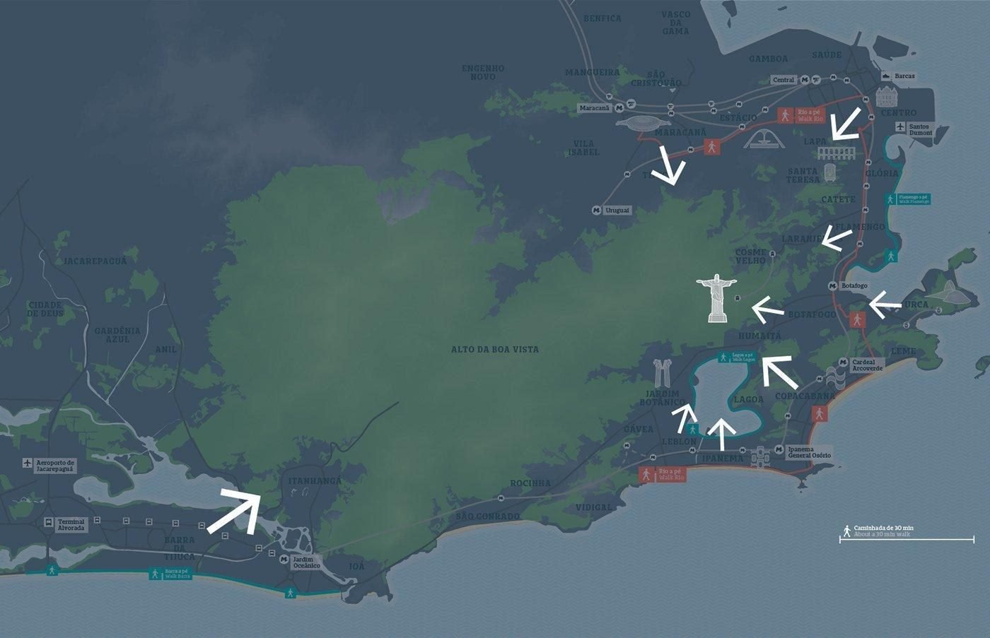
The maps have geographic north and a second one: Christ the Redeemer. From anywhere on the route, the map shows which way Christ is from where the reader is standing, as the arrows show.
The detailed maps started from the city’s map database, which was out of date, so names and labels were updated with an Illustrator plugin.
The simplified map on type 1 was made by hand, version by version: walking minutes along the route line, a 30-minute radius up close and the wider city around it.
Landmarks become icons
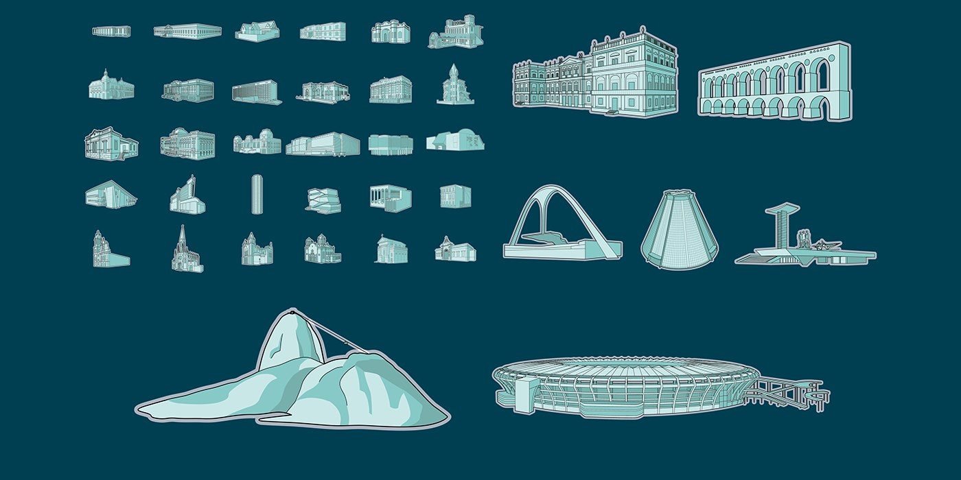
Illustrations of the city’s main landmarks appear on the maps and stand out on each region’s detailed map. The landmarks themselves became the language, so visitors can find their way on their own.
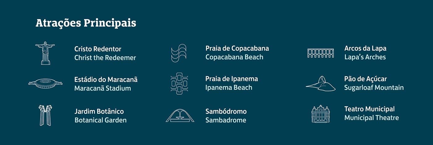
Main attractions
Christ the Redeemer, Maracanã, Botanical Garden, beaches, Sambadrome, Lapa Arches, Sugarloaf and the Municipal Theatre, in Portuguese and English.

Service icons
Transport, health, food, culture and beach, readable from afar and at a glance.
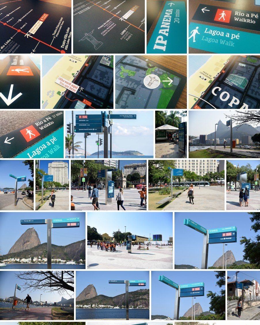
On the street
The signs installed along the beachfront and in the neighborhoods on the route. The pilot started in May 2015, with 17 totems in Leme and Copacabana.
On the street, a layout error is there for everyone to see, and BandNews Rio did report signs like that. That is why every review was done against the map. The final artwork for every sign except the simplified map came out of Adobe ExtendScript scripts: the team only reviewed it, and whenever changes came in, which was often, the script simply ran again.
Impact
500 signs linking Rio’s five tourist regions on foot, in time for the 2016 Games.
Credits
- Commissioned by
- Brazil’s Ministry of Tourism, City of Rio and Riotur
- System planning and design
- Applied Wayfinding, London
- VL design
- Valéria London
- ICON
- Waldemar Felinto
- Design and wayfinding
- Diogo Cadaval, Gabriel Scherer, Guilherme Howat, Gustavo Soares, Marco Luz, Caio Colin, Eric Aguillar, Jamesson James, João Lamar, Leandro Vilela, Viviani Carnielli
- Production
- Fernanda Gaertner, Monica Machado